![]()
Senegal River (Mali, Guinea, Mauritania)
 Tweet
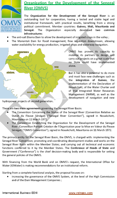
TweetOrganisation for the Development of the Senegal River (Mauritania)

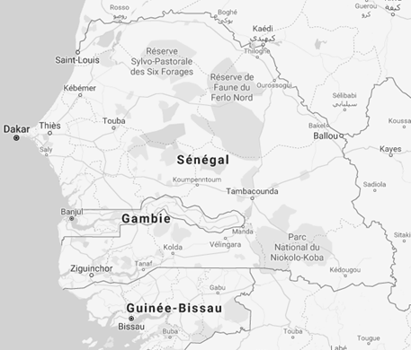
The Senegal River (1.750 kilometres) crosses four West African countries:
Features of the Senegal River:
- Length of the Senegal River: 1,750 kilometres
- Area of the Senegal Basin: 337,000 km²
- The Senegal River shapes the border between Senegal and Mauritania
- Regions of the Senegal River
- High basin
- Bakel Valley (Saint-Louis, Senegal)
- Delta of the Senegal
- Origin of the Senegal River: Bafoulabé, in Mali (Fouta-Djalon massif) and Guinea
- Tributaries of the Senegal River:
- Bafing (main branch)
- Bakoye
- Falémé (Mali-Senegal Border)
- Others tributaries of the Senegal River are:
- Colimbiné
- Karakoro
- Ghorfa
- Gorgol
- Navigation:
- All stations: 175 kilometres (River mouth of the Senegal River, Saint-Louis, Richard Toll, Podor (Senegal)
- High water period (three months yearly): 975 kilometres (River mouth of the Senegal River, Saint-Louis, Podor, Kayes -Mali-)
- The integrated management of water resources of the Senegal River is carried out by the Organisation for the Development of the Senegal River
More information about the Organisation for the Development of the Senegal River, at EENI Global Business School Website.
Academic Programs related to the Senegal River region

- Course: International Trade and Business in West Africa
- Masters: International Trade and Business in Africa, Transport and Logistics in Africa
- Doctorate in African Business
Economic Organisations in the region of the Senegal Basin
- West African Economic and Monetary Union (WAEMU)
- Economic Community of West African States (ECOWAS)
- Community of Sahel-Saharan States (CEN-SAD)
- West African Monetary Zone (WAMZ)
 Río Senegal
 Fleuve Sénégal
 Rio Senegal